News from the South - Louisiana News Feed
Scattered storms possible the next two days and staying warm
SUMMARY: This week, tropical weather is calm with no significant impacts expected locally. Rain chances will start off higher but decrease as temperatures rise. While Tropical Depression Gordon churns in the Atlantic, it is likely to remain out at sea, causing potential rain along the Southeastern US coast, particularly in areas like Myrtle Beach and Charleston. Locally, expect scattered storms mainly on the coast. Morning temperatures will be mild, with highs around 88°F by midweek. Overall, anticipate a quiet weather week ahead, although some isolated storms may occur Monday and Tuesday, before a return to drier conditions.
Meteorologist Devon Lucie walks us through the week ahead with rain chances the next two days, when and where they’re most likely and how hot you’ll be, then takes us into the extended forecast where a bubble of high pressure begins to take over reducing our rain chances and allowing our high temps to creep up a little further, while also covering what’s shaping up in the tropics with our newest system that’s formed off the coast of the Southeastern U.S. showing where it’s headed and what it will bring and also takes a glance at Tropical Depression Gordon that’s churning over the open waters in the Atlantic, while finishing up with the seven day forecast highlighting the rain chances over the next seven days, high temperatures, and any other weather impacts such as patchy fog you might run into in the morning.
Subscribe to WDSU on YouTube now for more: http://bit.ly/1n00vnY
Get more New Orleans news: http://www.wdsu.com
Like us: http://www.facebook.com/wdsutv
Follow us: http://twitter.com/wdsu
Instagram: https://www.instagram.com/wdsu6/


News from the South - Louisiana News Feed
Saturday 10 PM Tropics Update: One far-off tropical wave to watch
SUMMARY: A tropical wave near Africa is emerging over the Atlantic but remains disorganized. The National Hurricane Center gives it a 60% chance to develop into a depression or tropical storm, possibly becoming Gabrielle. This system may move northward, staying over the open Atlantic and away from the Gulf, posing no immediate threat. Since the last named storm in late August, stable air, dry conditions, and increased wind shear have suppressed tropical activity in the Atlantic. The next storm names are Gabrielle, Humberto, and Imelda, with only the current wave showing potential for development at this time.
Meteorologist Alexandra Cranford tracks a lone disturbance with a chance of development on Saturday night, September 13, 2025.
News from the South - Louisiana News Feed
Haynes wanted in on Wildlife bribery scheme too, informant says
SUMMARY: Dusty Guidry, a former consultant who pleaded guilty to accepting $800,000 in bribes, testified that Assistant District Attorney Gary Haynes sought involvement in a bribery scheme at the Louisiana Department of Wildlife & Fisheries. Haynes, on trial for conspiracy, bribery, money laundering, and obstruction, was previously appointed to run Lafayette’s pretrial diversion program after supporting DA Don Landry. Guidry revealed Haynes pressured him to include him in a similar diversion program scheme at Wildlife & Fisheries, receiving checks totaling $90,000. The scheme involved splitting bribes among Guidry, vendor Leonard Franques, and former department secretary Jack Montoucet, who has also been charged. The statewide program never launched.
Read the full article
The post Haynes wanted in on Wildlife bribery scheme too, informant says appeared first on thecurrentla.com
SUMMARY: The Ouachita Parish Police Jury is conducting a series of community meetings to gather public input for their comprehensive plan guiding future growth. Police Jury members, including Larry Bratton from District D, emphasize the importance of reflecting residents’ voices in the master plan. Community members participated in interactive stations, allocating resources to priorities like infrastructure and downtown development, to help shape goals for the next 2, 5, and 20 years. Landscape architect Matt Pizatella and partners from Atlas support the effort. Bratton stresses that without proactive planning, the parish risks costly and less beneficial outcomes in the long term.
OPPJ Comprehensive Plan

NCAA eliminates spring transfer period for football

US stocks churn amid uncertainty about how many more rate cuts are coming from the Fed
The Sound of the South: Mississippi’s Songbook

Prosecutors already have dropped nearly a dozen cases from Trump’s DC crime surge, judge says

15-minute parking spots added in downtown Gulfport to ease congestion during renovations

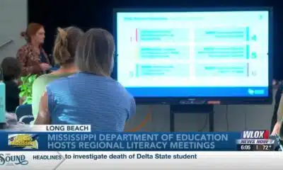
Statewide literacy meetings aim to boost reading skills and family engagement
Rep. Bennie Thompson calling on federal investigation into Delta State student’s death

A Sanctuary in Goodman: The Magic of the Public Library

Suspect in Charlie Kirk killing is charged with murder as prosecutor says DNA found on rifle trigger

Hyde-Smith, Warnock team up to recognize Gold Star Families Remembrance Week

What we know about Charlie Kirk shooting suspect, how he was caught

Federal hate crime charge sought in Charlotte stabbing | North Carolina

Screech Owls – Small but Cute

NW Arkansas Championship expected to bring money to Rogers

Under pressure, some immigrants are leaving American dreams behind

Huntsville Fire & Rescue Holds 9/11 Memorial Service | Sept. 11, 2025 | News 19 at 5 p.m.

Haynes wanted in on Wildlife bribery scheme too, informant says

Mississippi Science Fest showcases STEAM events, activities

CBS Miami highlights free mammogram program with mobile mammovan

Safe Central Texas meet-up spots for online purchases
15-minute parking spots added in downtown Gulfport to ease congestion during renovations
Statewide literacy meetings aim to boost reading skills and family engagement

Saints Report: Saints lose another close game this time in week two against the San Francisco 49ers

Harrison County approves budget with no tax increase

‘Little quiet light’: Family remembers Delta State University student found dead on campus

The Mustard Seed

WXXV Game of the Week: Week 3

White House officials hold prayer vigil for Charlie Kirk

Jonesboro band culture responsible for global legacy | FOX 5

Family, friends hold candlelight vigil in honor of Giovanni Pelletier
-

 News from the South - North Carolina News Feed6 days ago
What we know about Charlie Kirk shooting suspect, how he was caught
-
 News from the South - North Carolina News Feed6 days ago
Federal hate crime charge sought in Charlotte stabbing | North Carolina
-
Our Mississippi Home5 days ago
Screech Owls – Small but Cute
-
News from the South - Arkansas News Feed6 days ago
NW Arkansas Championship expected to bring money to Rogers
-
News from the South - North Carolina News Feed6 days ago
Under pressure, some immigrants are leaving American dreams behind
-
News from the South - Alabama News Feed7 days ago
Huntsville Fire & Rescue Holds 9/11 Memorial Service | Sept. 11, 2025 | News 19 at 5 p.m.
-
News from the South - Louisiana News Feed7 days ago
Haynes wanted in on Wildlife bribery scheme too, informant says
-
Mississippi News Video6 days ago
Mississippi Science Fest showcases STEAM events, activities