News from the South - Texas News Feed
Why Texas’ Hill Country keeps flooding
“Hills, rivers and rocky terrain: Why the Hill Country keeps flooding” was first published by The Texas Tribune, a nonprofit, nonpartisan media organization that informs Texans — and engages with them — about public policy, politics, government and statewide issues.
Sign up for The Brief, The Texas Tribune’s daily newsletter that keeps readers up to speed on the most essential Texas news.
When floodwaters tore through the Texas Hill Country on July Fourth weekend, killing more than 100 people — including campers and counselors at an all-girls summer camp along the Guadalupe River — Kerr County Judge Rob Kelly was quick to voice shock.
“We didn’t know this flood was coming,” Kelly said. Yet in nearly the same breath, he acknowledged that the region is “the most dangerous river valley in the United States” — one that deals with floods “on a regular basis.”
That contradiction — an expectation of danger paired with apparent surprise — has become tragically familiar in Central Texas.
Despite being part of a wide swath of Texas nicknamed “Flash Flood Alley,” this part of the Hill Country continues to suffer devastating losses — both in human lives and property — after floods that scientists and emergency planners have warned about for decades.
The region includes several Texas river basins: the Colorado, the Guadalupe and the San Antonio.
Between 2 and 7 a.m. July 4, the Guadalupe River in Kerrville rose 35 feet, according to a flood gauge in the area. The flooded river swallowed roads, bridges, entire RV parks and structures along the Guadalupe’s banks.
The region has a history drenched in loss, marked by some of the state’s most deadly floods.
Nearly a century ago in 1932, hard rains pushed the Guadalupe River out of its banks. That destructive flooding drowned seven people and property losses exceeded $500,000 — equivalent to $11.8 million today. A blog post by Kerrville Mayor Joe H. Herring Jr. recounted the story of a teen trapped in a tree for 23 hours during that flood and the men that tried to save him.
“The story of July 1, 1932 is a story of warning, and a story with heroes,” Herring wrote.
In 1978, a tropical storm stalled over the headwaters of the Guadalupe and Medina Rivers. The resulting flood drowned 33 people, causing millions of dollars in property damages, ravaging roads, bridges and ranchland.
Less than a decade later, in 1987, an intense summer storm dumped about 11.5 inches of rain in mid-July near the headwaters of the Guadalupe River, sending a massive flood wave through Ingram, Kerrville and Comfort. As the wall of water rushed through a church camp near Comfort, a bus and a van attempted to evacuate campers but stalled in rapidly rising water. Ten teenagers drowned and 33 other people were injured — a tragedy that some officials alluded to in recent days when defending the lack of evacuations before the July 4 flood.
Most recently, on Memorial Day weekend in 2015, heavy rainfall upstream on the Blanco River caused flash flooding in Wimberley, uprooting centuries-old trees and damaging or destroying nearly 400 homes along its banks, displacing hundreds of residents. The river rose approximately 5 feet every 15 minutes, cresting near 50 feet. Thirteen people died in the flood.
“People new to the area may not know the history. The climate doesn’t look like a place where flooding happens often. It’s hot, semi-arid. It’s deceptive,” said Todd Votteler, a longtime water policy expert and former executive manager at the Guadalupe-Blanco River Authority.
As water expert and environmental consultant Matthew Berg put it: “Rivers have a lot longer memory than we do.”
The magnet of the rivers
People are drawn to the Texas Hill Country for its natural beauty. It’s a place where families camp under starry skies, fish in spring-fed creeks, and cool off in deep swimming holes carved into limestone.
But the very features that make this region so appealing — its hills, rivers, and rocky terrain — also make it one of the most flood-prone areas in the country.
On topographical maps, the terrain resembled elephant skin, with countless folds worn into the hills by centuries of runoff. The hilly land has dramatic elevation changes caused by the Balcones Escarpment, a major geological feature that cuts across Central Texas.
Tropical storms routinely hit the escarpment and dump heavy rain, said Avantika Gori, a flood risk expert and civil and environmental engineering professor at Rice University. Last week, the storms that caused the flash floods in the Hill Country were intensified by the moisture from the remnants of Tropical Storm Barry.
And when storms roll in, water rushes downhill fast, gaining speed and force as it moves.
There’s little to slow it down — thin, rocky soil doesn’t absorb much water, and exposed bedrock and sparse vegetation offer no buffer. Clay-rich soils in parts of the region also prevent infiltration, meaning rain turns to runoff almost immediately.
“It’s like the region’s been paved over with concrete,” said Gori. “So the water falls, and it just runs off. And then, because of the steep slope, you get these really fast-moving waves of water.”
Robert Mace, a hydrologist and executive director of the Meadows Center at Texas State University, calls it “a recipe for catastrophic floods.”
Storms becoming more intense
On July 4, the floods struck at perhaps the worst possible moment — in the early morning hours at the start of a holiday weekend that had drawn large numbers of people to the river.
The National Weather Service issued a flood watch Thursday afternoon, predicting isolated rainfall of up to seven inches. It issued a flash flood warning that included Kerr County after 1 a.m. Friday, when most people were asleep, and declared a flash flood emergency — the most severe alert possible — around 4 a.m.
“Many storms form at night,” said Votteler, the water policy expert.
The huge loss of life from Friday’s flood — which is likely to grow higher with at least two dozen people still missing in several counties — has raised new questions about what local, state and federal officials could have or should have done to better warn people near the river.
John Nielsen-Gammon, the state’s climatologist, said the severity of storms is also changing. Climate change has caused warmer air that can hold more water, leading to more intense rainfall. Ocean heat fuels stronger tropical systems.
Mace, the hydrologist, said what was once a 500-year flood is increasingly happening every few decades.
“Floodplain maps are based on historical data,” said Mace. “They don’t reflect the current — or future — risk. It’s backward-looking in a forward-moving crisis.”
Disclosure: Rice University has been a financial supporter of The Texas Tribune, a nonprofit, nonpartisan news organization that is funded in part by donations from members, foundations and corporate sponsors. Financial supporters play no role in the Tribune’s journalism. Find a complete list of them here.
This article originally appeared in The Texas Tribune at https://www.texastribune.org/2025/07/08/flooding-history-texas-hill-country/.
The Texas Tribune is a member-supported, nonpartisan newsroom informing and engaging Texans on state politics and policy. Learn more at texastribune.org.
The post Why Texas’ Hill Country keeps flooding appeared first on feeds.texastribune.org

Note: The following A.I. based commentary is not part of the original article, reproduced above, but is offered in the hopes that it will promote greater media literacy and critical thinking, by making any potential bias more visible to the reader –Staff Editor.
Political Bias Rating: Centrist
This article reports factually on the recent Texas Hill Country floods, providing historical context, expert analysis, and official statements without evident ideological framing. It emphasizes the natural geography, increasing storm intensity linked to climate factors, and public safety concerns. The tone remains neutral, avoiding partisan language or blame while including diverse expert perspectives. Although it references climate change scientifically, it does so as part of accepted environmental factors rather than a politicized argument. Overall, the piece adheres to balanced, straightforward reporting, presenting information for readers to draw their own conclusions.


“Weather warnings gave officials a 3 hour, 21 minute window to save lives in Kerr County. What happened then remains unclear.” was first published by The Texas Tribune, a nonprofit, nonpartisan media organization that informs Texans — and engages with them — about public policy, politics, government and statewide issues.
Sign up for The Brief, The Texas Tribune’s daily newsletter that keeps readers up to speed on the most essential Texas news.
Three hours and 21 minutes.
That’s how much time passed from when the National Weather Service sent out its first flash flood warning for part of Kerr County to when the first flooding reports came in from low-lying water crossings.
The weather service says that first warning triggered one of many automatic alerts to cell phones and weather radios, telling people in the area of the danger.
But if any local officials got those warnings, and if so, whether they activated in any meaningful way in that 3 hours and 21 minutes remains a black box.
County officials have not responded to requests for interviews and have not said at public press conferences what efforts they took when the flooding threat turned from possible to imminent in the middle of the night. At those press conferences, Kerrville’s city manager has repeatedly said they are focused on search and rescue, rather than answer questions about their response.
“We knew there was a flash flood warning,” Gov. Greg Abbott said at a press conference on Tuesday. “No one would know that would be a 30-foot-high tsunami-ball of water.”
NWS officials said they communicated directly with local officials during the night of the floods, but did not specify when. In some cases, they said, calls went to voicemail. Kerrville’s mayor said he was unaware of the flooding until around 5:30 a.m., more than four hours after that first warning, when the city manager called and woke him up.
Warnings didn’t go up on county Facebook pages until around the same time — when the Guadalupe River had already risen rapidly and pushed out of its banks around Hunt and was making its way toward the county seat of Kerrville.
Weather experts say that — from the outside at least — weather service forecasters appear to have done most everything right as the river rose with astonishing speed, blew past its previous record level and blasted through summer camps, RV parks, homes and campgrounds. It’s the kind of situation that meteorologists warn trainees about, the sort of nightmare scenario some refer to as a silent killer. A holiday weekend that brings out-of-town visitors to the area known as “Flash Flood Alley.”
The worst of the danger arrived in the dark, while people slept. The river claimed more than 90 lives in Kerr County, where many people were still missing more than four days later.
The weather service on Thursday afternoon put out a flood watch, which is a specific threat designation that means the conditions are present for a flood to happen.
“That far ahead of an event like this, that’s the most you can do,” said Bob Henson, a meteorologist and journalist with Yale Climate Connections.
And the agency issued increasingly urgent warnings through the night, which should have given most people enough time to escape death if they received and understood them, said Daniel Swain, a climate scientist with the University of California Agriculture and Natural Resources.
Questions remain about whether people along the river had cell service to get the push alerts, had alerts enabled on their phones, or were even awake to heed them.
Had they been warned of the coming flood, many people could have walked in the rainy darkness to higher ground.
“This really does appear to be a case where had there been even a modest acknowledgement of the level of danger that was predicted by the weather service, I don’t think much of the scope of loss of life would have happened,” Swain said in a public video call Monday.
Thursday afternoon: the first flood watch
Emergency officials across Central Texas had reasons to pay attention to the skies well before the deadly flooding occurred and the July 4 holiday weekend got into full swing. Federal forecasters issued a flood watch for a swath of the state at 1:18 p.m. Thursday, including for Kerr County, where at least 30 children would die. Nineteen other people have been confirmed dead in other counties from the widespread floods as of late Tuesday.
A flood watch is intended to indicate to local emergency officials and others that they should be on the lookout, weather experts said. Forecasts on Thursday didn’t say exactly where the worst rain might fall and how much — because that’s very difficult to predict so far ahead, meteorologists said. Where exactly the rain falls can make a big difference in river forecasting.
“I look at flash flood events like this very similarly to tornadoes,” said Alan Gerard, a retired NOAA meteorologist and current CEO of Balanced Weather. “We can tell you the conditions are favorable … but we can’t tell you exactly how strong the tornado is going to be and whether or not it’s going to hit your house.”
Kerr County is part of the Texas Hill Country, where the limestone hills lack deep layers of soil to absorb water. Rivers can rise shockingly fast. Deadly flood events have happened there repeatedly in the past.
The Texas Division of Emergency Management had activated rescue teams and bumped up its readiness level Thursday to bring more help on board. Lt. Gov. Dan Patrick said the regional director for TDEM personally called local officials to discuss the brewing storm. A state rescue task force, military vehicles and aircraft were stationed in the region, mostly in San Antonio, TDEM Chief Nim Kidd said during a press conference Friday night.
But whether Kerr County officials got a call or took any particular action after the July 3 flood watch went out is unclear. At a news conference on Friday as the death toll rose, Kerr County Judge Rob Kelly said, “We didn’t know this flood was coming.”
Neither Kelly, the county sheriff nor the emergency management coordinator responded to requests for interviews.
Part of the problem could be alert fatigue, especially in an area known for frequent flooding. People often receive multiple flood watches that don’t result in actual flooding, said Avantika Gori, an assistant professor of civil & environmental engineering at Rice University and flood risk expert. This can lead to complacency, with people thinking, “It’s just another one of those things,” she said.
They may also not understand the difference between a watch and warning, Gori said.
The first flash flood warning: Friday 1:14 a.m.
Kerrville Mayor Joe Herring, 63, who grew up in the city, recalled seeing reports Thursday night of a chance of rain around the time of the July 4 kids’ bike parade the next day. A friend warned him heavy rain was possible across a large area, but he didn’t feel worried.
“I went outside and looked at the clouds and thought someone is going to get rain, but it’s not going to be us,” he said. He said thunder woke him around midnight, and he was glad to see some rain falling. The Hill Country was in a significant drought.
More specific warnings, which indicate flooding is occurring or imminent, came later in the night as the forecast developed and data poured in. Extra people were on duty at the weather service office in New Braunfels, said Erica Cei, a weather service spokesperson.
At 1:14 a.m., the National Weather Service pushed out its first flash flood warning for central Kerr County, saying that data indicated life-threatening flash flooding was occurring or would begin soon. That message automatically triggered alerts to radios and cell phones, Cei said.
At that point, the river had barely started to rise.
The river was still within its banks in most places, and the incongruity between the warning and what people saw on the ground could potentially have caused people not to take action, Erik Nielsen, an instructional assistant professor at Texas A&M University, said in an email. It’s just one of many challenges of issuing effective warnings that are hard to overcome, he said.
People like Valerie Peters, who was staying at a Kerrville RV campsite called Jellystone Park, woke to the rainfall at some point and said she didn’t notice anything out of the ordinary. She said she looked at the emergency notifications, shut the sound off and she went back to bed.
She had been looking forward to a weekend of painting, karaoke and cornhole tournaments with her family. Luckily, her campsite avoided serious damage.
“We could have died,” Peters said. “We had no idea how serious this rain was.”
For officials in the early morning hours, there was still time to act as the rain pounded.
At 4:03 a.m., two hours and 49 minutes after their initial flood warning, federal forecasters warned that the rain had created a flash flood emergency for south-central Kerr County. Weather forecasters only use that term in what the agency says are “exceedingly rare” cases to indicate that lives are very much at risk.
“This is a PARTICULARLY DANGEROUS SITUATION. SEEK HIGHER GROUND NOW!” the warning said.
The Guadalupe River was rising precipitously. In the nearly three hours since the first warning went out, it had risen 14.3 feet, according to the river level gauge near Hunt, upriver from Kerrville. It would rise another 15.5 feet, according to the data, before the gauge broke.
At 4:35 a.m., three hours and 21 minutes after the first warning, the weather service office started to get reports from the Kerr County sheriff’s office of low-level flooding, Cei said. The river was still rising.
Forecasters pushed out a second flash flood emergency alert at 5:34 a.m., now for east central Kerr County, saying that “a large and deadly flood wave” was headed down the Guadalupe River.
Again, they urged people to get to higher ground immediately. They described the threat of damage as catastrophic.
That was about the time the Kerr County Sheriff’s Office took to Facebook to warn “DANGEROUS FLOODING NOW.” On its Facebook page, Kerr County also posted a warning around then that the river was flooding.
Kerrville’s city manager — who told reporters that he’d been jogging near the river at 3:30 a.m. and saw no signs of flooding — woke the mayor with a phone call around 5:30 a.m. and told him the downtown park where a lot of the July 4th events were planned was under water.
Herring said he threw on some clothes and went downtown.
He got an alert on his phone from the CodeRED system the county uses at 6 a.m., he said, indicating a flash flood alert or “something to that effect.“ Residents can enroll in the system to get alerts. He said it was the only weather alert he got that morning.
The “last mile” weather alert problem
Communicating these developing threats as forecasts become more clear is what meteorologists call a “last mile” problem — and it’s long plagued the field. Even as weather service forecasters are issuing warnings, they might have no idea who’s listening or monitoring the situation from the other side.
“The big question marks are, who was the National Weather Service able to reach in person and who was able to monitor the automated warnings that went out through cell phones, through email blasts and so forth at 1, 2, 3, 4 a.m.,” said Henson, the meteorologist with Yale Climate Connections. “And that just comes down to county, local, and even to individual entities like campgrounds.”
At National Weather Service weather forecast offices, it falls to the warning coordination meteorologist — in this case Paul Yura, who retired from a decades-long career in April, a few years earlier than he planned — to build relationships with local community members to prepare for events such as this.
The White House on Monday defended the forecasting agency in the face of questions about whether nationwide staffing cuts had impacted their work.
Two of Mayor Herring’s close friends — Jane Ragsdale, director of the Heart O’ The Hills camp and Dick Eastland, one of the owners of Camp Mystic — died in the flooding and their deaths have hit him hard. He felt sure both would have checked the weather.
“I wish to God there had been some way to warn them,” he said.
Terri Langford, Ayden Runnels, Jaden Edison and Alejandra Martinez contributed reporting.
Disclosure: Facebook, Rice University and Texas A&M University have been financial supporters of The Texas Tribune, a nonprofit, nonpartisan news organization that is funded in part by donations from members, foundations and corporate sponsors. Financial supporters play no role in the Tribune’s journalism. Find a complete list of them here.
Shape the future of Texas at the 15th annual Texas Tribune Festival, happening Nov. 13–15 in downtown Austin! We bring together Texas’ most inspiring thinkers, leaders and innovators to discuss the issues that matter to you. Get tickets now and join us this November.
TribFest 2025 is presented by JPMorganChase.
This article originally appeared in The Texas Tribune at https://www.texastribune.org/2025/07/08/texas-weather-service-warning-kerr-county/.
The Texas Tribune is a member-supported, nonpartisan newsroom informing and engaging Texans on state politics and policy. Learn more at texastribune.org.
The post Warnings gave Kerr County officials hours to act before flood appeared first on feeds.texastribune.org
Note: The following A.I. based commentary is not part of the original article, reproduced above, but is offered in the hopes that it will promote greater media literacy and critical thinking, by making any potential bias more visible to the reader –Staff Editor.
Political Bias Rating: Centrist
The content provides a detailed, fact-based report on the events surrounding a deadly flood in Kerr County, Texas. It presents statements from various officials across the political spectrum, including Texas Governor Greg Abbott and Lt. Gov. Dan Patrick, without undue criticism or praise. The article focuses on the timeline and effectiveness of warnings from the National Weather Service and local officials, relying heavily on expert opinions and factual accounts. There is no evident editorializing or partisan framing; rather, it emphasizes public safety and accountability in emergency responses. This approach aligns with a neutral, centrist stance aimed at informing readers rather than advancing a political agenda.
SUMMARY: Catastrophic flooding in Texas’s Hill Country has claimed over 100 lives, including at least 27 campers and counselors at Camp Mystic, an all-girls Christian summer camp. Search efforts continue amid improving weather, though hopes of finding survivors dim. The floodwaters surged along the Guadalupe River, sweeping away people and debris. Questions arise about local officials’ warnings ahead of the disaster, with some camps managing to move campers to safety while others were caught off guard. In Kerr County alone, 84 bodies have been recovered, including 28 children. Hundreds of volunteers and rescue teams work through challenging terrain to find the missing.
The post Hope for Texas flood survivors dims as search continues appeared first on www.kxan.com
News from the South - Texas News Feed
Inside Amazon Prime Day: how small businesses like Nodnal are thriving
SUMMARY: Amazon Prime Day, extended to four days this year, is driving huge sales, with a local Houston same-day delivery warehouse working nonstop to fulfill orders. About 60% of Amazon sales come from independent small and medium businesses, including Houston-based Valo. Founded in 2017 by Leali and Brandon, Valo offers eco-friendly, gender-neutral, 100% cotton baby bedding designed by Leali’s wife. Partnering with Amazon has allowed Valo to reach a wider customer base and offer fast shipping options they couldn’t manage alone. The soft quality of their products has impressed many, highlighting the success of small businesses on Amazon Prime Day.
Amazon Prime Day starts today, and 60% of sales come from independent businesses! Julissa Garza visits an Amazon fulfillment …

Warnings gave Kerr County officials hours to act before flood

Ike was ‘underrated,’ FDR ‘amazing,’ Polk ‘sort of a real-estate guy’

MDMR-USM Hatchery Training Program Enters Production Phase with Oyster Spawning and Mobile Unit Launch

Get ready to pass through US airport security checkpoints with your shoes on your feet

Arkansas Department of Education creates searchable child care provider database

3 arrested after driving through I-240 crash scene

Parked cars are now a leading source of stolen guns, new report finds

JENNIE: Joy Roberts shares her personal "full circle" journey from foster/adopted child… to becoming a foster/adoptive parent

Mississippi Children’s Museum opens ‘May Belle the Cow’ exhibit

Leawood changes street tree ordinance, launches sidewalk repair program

Attorneys who run public defender offices replaced amid contract turmoil

Gov. Kay Ivey expected to name Alabama parole board pick in coming days

Real-life Uncle Sam's descendants live in Arkansas

Officials report average eagle nesting season in coastal Georgia, nearly 200 eaglets fledged statewide

Man arrested after alleged strangulation of adult and juvenile

In small-town Kentucky, finding ‘all the more reason to resist’

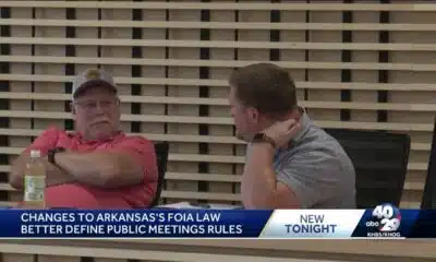
Centerton prepares for new FOIA law taking effect in August

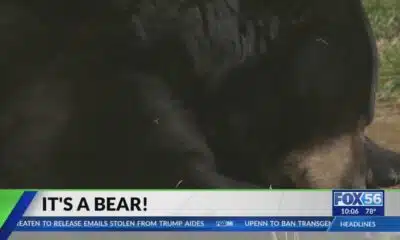
Bear sightings happening in central Kentucky: What to know
Bank robbery suspect arrested in suburban home neighbors say they warned about

MHP holiday travel enforcement period begins

Death toll from catastrophic flooding in Texas surpasses 100

Changes to Georgia landlord-tenant law | FOX 5 News

Pair of 10-year-olds set fire to three school buses in Mississippi, sheriff says

See Rodgers and Hammerstein’s Cinderella at COCA this summer!

Inside Amazon Prime Day: how small businesses like Nodnal are thriving

JPS to host Job Fair on July 10

Special election set after two illegal votes in Pearl River County tax assessor race

The dangers of using a wire brush

Dog fight, pets dying, staff high on drugs: WRAL Investigates violations at pet boarding facilities

Crews maintain 22-miles of trails in Aspire park
-

 News from the South - Louisiana News Feed7 days ago
Attorneys who run public defender offices replaced amid contract turmoil
-
News from the South - Arkansas News Feed4 days ago
Real-life Uncle Sam's descendants live in Arkansas
-
News from the South - Georgia News Feed7 days ago
Officials report average eagle nesting season in coastal Georgia, nearly 200 eaglets fledged statewide
-
News from the South - Alabama News Feed6 days ago
Gov. Kay Ivey expected to name Alabama parole board pick in coming days
-
News from the South - Kentucky News Feed6 days ago
Man arrested after alleged strangulation of adult and juvenile
-
News from the South - Kentucky News Feed7 days ago
In small-town Kentucky, finding ‘all the more reason to resist’
-
News from the South - Arkansas News Feed7 days ago
Centerton prepares for new FOIA law taking effect in August
-
News from the South - Kentucky News Feed7 days ago
Bear sightings happening in central Kentucky: What to know