The “Pit of Despair” in downtown Asheville, bought by the city in 2003 for $2.4 million, remains undeveloped after nearly two decades. Initially cleared of old structures and partially beautified, it still looks like an eyesore despite plans for a $13 million downtown park approved in 2020. Temporary event programming is ongoing, but significant development seems far off. On Merrimon Avenue, private homeowners legally installed razor wire on their backyard fence, prompting no city action since it’s private property. Lastly, leftover dirt along I-26 east near Long Shoals Road is being used to grade an embankment, not an access road.
Happy Independence Day, everyone! I hope your day is a blast! A safe blast, that is…
Let’s get to today’s round of questions, my smart-aleck replies and the real answers:
Question: I’m wondering if you have any news about Asheville’s Pit of Despair. I haven’t heard anything, although I do remember reading that consultants had been hired to come up with a plan. Any feedback you could give me would be appreciated.
My answer: Look, the first 20 years of a project like this are set aside for letting the property properly marinate. Then you have to let any plans stew for five to 10 years to reach proper tenderness. Then you’re ready to add the seasoning, such as a park bench or maybe a tree. And then you realize the whole shebang just got swallowed by an Asheville sinkhole.
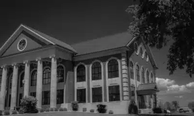
Real answer: You may think I’m exaggerating about the time frame, but the Pit of Despair has been inspiring hopelessness since 2003, when the city bought it for $2.4 million. Located at 68 Haywood St., the pit has remained vacant since then, although it has been home to the occasional outdoor table or temporary use.
But it’s still a pit, and a prime piece of downtown real estate. It’s right across the street from the Harrah’s Cherokee Center-Asheville, which comprises the Thomas Wolfe Auditorium and the Exploreasheville.com arena, the city’s two main performance venues.
Shortly after buying the property, the city did tear down a dilapidated parking deck and the former Flying Frog restaurant. It also installed faux stone walls to make it less of an eyesore, but alas, it remains a gravel-bottom, concrete-block-lined ode to municipal melancholy.
Back in the day, before the city took it over, a developer was going to turn it into a hotel and probably a convention center — yes, a crazy use for such a space — but that plan got mired in lawsuits. And the property lingered.
In 2020, City Council boldly decided the property should become another downtown park, in this case one with a $13 million price tag.
But here we are, five years later with the Pit of Despair still looking like the Depression of Despondency. Hey, someone’s got to try to give this place a new nickname.
But wait, action is on the horizon. Well, maybe not action, but at least some semblance thereof. Let’s call it “exploration.”
“Our Temporary Activation Program team is exploring regular programming of this site as part of the community’s overall Helene economic recovery efforts,” City of Asheville spokesperson Kim Miller said via email. “In the meantime, Harrah’s Cherokee Center-Asheville has been programming the space around larger events held at the venue.”
Back in February, this included a six-day “shakedown street” event organized around the Billy Strings concerts held at Harrah’s Cherokee Center-Asheville.
“Next month, in conjunction with the Widespread Panic concerts to be held at the HCCA, another three-day shakedown street marketing (event) will be held at the space July 24-26, opening at 1 p.m. daily,” Miller said. “Outside of these city-initiated efforts, the site is available for outdoor special event permitting following a process that’s consistent with special event permitting on other city-owned properties.”
It’s a great spot for such events, especially if you enjoy a near total lack of shade and the inimitable ambience of concrete walls that sort of look like rocks. Sorry, that was snarky, wasn’t it?
“As your reader mentions, this parcel has been a topic of consideration for a number of years,” Miller said diplomatically. “A Master Design Plan was completed in 2020, incorporating input from robust community engagement efforts. A prior community vision document prioritized temporary uses of the site, which have been implemented since 2017.”
I suspect sometime in the 2030s, we might see some actual action on the site, or at least some very strenuous planning.
Question: I would like to know how it is possible for someone to put razor wire on top of their fence in a backyard in Asheville. This can be observed on Merrimon Avenue past Beaver Lake on the right side of the road.
My answer: I bet someone with the city is thinking a few strands of razor wire along the Pit of Despair sure would jazz the place up.
Real answer: Feeling a bit stalkerish, I did stop by this house a couple of times to try to ask the homeowners why they feel the need for razor wire at the bottom of their yard. It is kind of odd, as other areas of the fence look pretty normal.
Razor wire has been installed on the fence surrounding a house on Merrimon Avenue past Beaver Lake. Because it’s on private property and out of the public right of way, the installation is legal. // Watchdog photo by John Boyle
I suspect maybe they’re trying to keep bears out of the yard. At any rate, no one was home when I stopped by, and they didn’t answer a note I left behind.
But none of this is illegal.
“Our crews looked into this in the interest of public safety,” City Spokesperson Kim Miller told me. “The location, however, is on private property, out of the public right of way which the city can maintain.”
The city ordinance code applies only along public streets and alleys.
“When a resident has a concern about code compliance or other issues of that nature, they should lodge a concern through the Asheville App,” Miller said, noting you can find more information on the Compliance Division pages of the City of Asheville website.
Question: Driving on I-26 east between Long Shoals Road and the airport, work is being done on what appears to be the old part of I-26 east. Are they building an access road of some kind there? There’s a huge pile of dirt there they keep moving around.
My answer: If this is the exact amount of dirt as it would take to fill the Pit of Despair, I might have just broken the story of the century. I can see the headline now: “City to fill Pit of Despair, let it sit for two more decades.”
Real answer: Well, this is pretty mundane.
A reader wonders about the purpose of this big pile of dirt along I-26 east between Long Shoals Road and the airport. // Watchdog photo by John Boyle
“The contractor is depositing some leftover dirt from the Exit 35 area to here instead of an off-site location,” said Luke Middleton, resident engineer with the NCDOT’s Asheville office. “It will be shaped and then hydro-seeded later this fall.”
In other words, it’s going to become an embankment.
Exit 35 is the new exit added to the widening of I-26 in Buncombe County. It will serve the Pratt & Whitney plant, as well as other motorists.
Asheville Watchdog welcomes thoughtful reader comments on this story, which has been republished on our Facebook page. Please submit your comments there.
Asheville Watchdog is a nonprofit news team producing stories that matter to Asheville and Buncombe County. Got a question? Send it to John Boyle at jboyle@avlwatchdog.org or 828-337-0941. His Answer Man columns appear each Tuesday and Friday. The Watchdog’s reporting is made possible by donations from the community. To show your support for this vital public service go to avlwatchdog.org/support-our-publication/.
Note: The following A.I. based commentary is not part of the original article, reproduced above, but is offered in the hopes that it will promote greater media literacy and critical thinking, by making any potential bias more visible to the reader –Staff Editor.
Political Bias Rating: Centrist
This content demonstrates a neutral and fact-based approach typical of local community journalism. It focuses on reporting municipal issues such as city property development, local ordinances, and infrastructure projects without showing strong ideological leanings or partisan rhetoric. The tone is lighthearted and occasionally snarky, but it steers clear of advocating for a particular political agenda, reflecting a centrist bias that aims to inform rather than persuade.
www.thecentersquare.com – By Alan Wooten | The Center Square – (The Center Square – ) 2025-08-22 08:31:00
North Carolina’s main route through the Outer Banks, N.C. 12, remains closed on Ocracoke and Hatteras Islands after Hurricane Erin caused flooding and sand buildup. Closures are between the Northern Ferry Terminal and Pony Pens on Ocracoke, and between Marc Basnight Bridge and Hatteras Village on Hatteras Island. Road reopening depends on sand removal and pavement damage assessment. As of 5 a.m., Hurricane Erin was transitioning to a post-tropical storm about 425 miles south-southwest of Halifax, with 90 mph winds and moving at 22 mph. Hurricane-force winds extended 125 miles from the center; tropical storm-force winds reached 370 miles. No coastal warnings remain.
(The Center Square) – North Carolina’s primary driving route through the Outer Banks on Friday morning remained closed on Ocracoke Island and Hatteras Island.
N.C. 12 was washed over by water and sand from the ocean following the pass of Hurricane Erin. The closure on Ocracoke Island is between the Northern Ferry Terminal and the National Park Service Pony Pens; on Hatteras Island, it is between the Marc Basnight Bridge and Hatteras Village.
In addition to sand removal, pavement damage would determine how long sections of N.C. 12 are to remain closed.
In the 5 a.m. update from the National Hurricane Center, Erin was in the first stages of post-tropical transition about 425 miles south-southwest of Halifax, Nova Scotia, and about 700 miles north of Bermuda. Maximum sustained winds were 90 mph, and the movement had increased to 22 mph.
Hurricane force winds of 74 mph or greater were up to 125 miles from the center of the storm, and tropical storm force winds of 39 mph or greater had grown to 370 miles from the center. A gust of 56 mph was reported on Bermuda at Wade International Airport.
No coastal watches or warnings were in effect on the Atlantic Seaboard.
Note: The following A.I. based commentary is not part of the original article, reproduced above, but is offered in the hopes that it will promote greater media literacy and critical thinking, by making any potential bias more visible to the reader –Staff Editor.
Political Bias Rating: Centrist
The article provides a straightforward factual report about the closure of N.C. 12 due to the impact of Hurricane Erin. It relays information from official sources such as the National Hurricane Center without editorializing or inserting opinion. The language is neutral and focused solely on the event and its consequences, without promoting or criticizing any political stance or ideology. This adherence to objective reporting indicates no discernible political bias in the content.
Costco representatives met with Enka community residents to discuss plans for Asheville’s first Costco store at Enka Commerce Park, expected to be submitted to the city within weeks. The 25-acre site includes 839 parking spaces and preservation of the historic Enka clock tower. The city’s planning process may take 9-12 months, with construction lasting about a year after approvals. Residents voiced concerns about traffic congestion, as Costco stores can attract up to 600 vehicles per hour at peak times. A traffic study is underway, and Costco plans traffic mitigation and participation in the stalled Enka Heritage Trail greenway project.
Representatives from Costco and its affiliated development companies told local residents at a Enka community meeting Thursday night that the warehouse retailer plans to submit official plans for its first Asheville store to the city within two to four weeks.
The meeting, in which multiple residents expressed concerns about the prospect of increased traffic because of Costco’s popularity, marked the first significant update on the project since Asheville Watchdogbroke the news in March that the low-cost retailer had submitted plans to the city for a store situated on 25 acres within Enka Commerce Park, with 839 parking spaces.
At the time, The Watchdog had obtained plans that also showed the preservation of the nearby historic Enka clock tower, which officials reiterated was a priority Thursday.
Renee Rutherford, Costco’s director of real estate, told about 25 people gathered in a meeting space by the Enka-Candler Library that the project is moving ahead, but it will take time.
“This is the first part of a long approval process,” Rutherford said. “We haven’t submitted anything to the town yet.”
Nettie Boyle, a project manager with BL Companies, which is handling design and architecture elements of the project, said after the meeting that the entire planning and approval process with the city could take nine to 12 months. (Boyle is not related to this article’s author.)
Nettie Boyle, a project manager with BL Companies, which is handling design and architecture elements of the Costco project in Enka, said after the Thursday evening meeting that the entire planning and approval process with the city could take nine to 12 months. // Watchdog photo by John Boyle
“So this is the first process — the neighborhood meeting — and then I believe it’s 14 days later, we can submit our preliminary site plan to the city,” said Boyle.
Costco has not finalized the purchase of the land from the owner, Martin Lewis, but it has signed a nonbinding letter of intent to buy the property, Rutherford said. After the permitting and design process, construction could take another year, Rutherford said.
Will Palmquist, principal planner with the city’s Planning & Urban Design department, said previously that Costco had scheduled an early July review meeting with the city’s Technical Review Committee. Palmquist said the project would require a conditional zoning, as it’s more than 100,000 square feet.
Once plans are submitted, it will next head to the Planning & Zoning Commission. The commission’s recommendation would be forwarded to City Council for the final decision.
Traffic a huge concern
Many locals expressed joy following the initial announcement last spring, as the current nearest Costco to Asheville is in Spartanburg, South Carolina, about 70 miles away.
But multiple residents at the meeting expressed concerns about Costco’s potential impact on traffic because it will likely draw customers from a wide area. Rutherford said Costco stores, which are open seven days a week, can draw about 600 vehicles an hour, although she stressed that occurs at peak shopping times.
The Biltmore Lake neighborhood, which has more than 800 homes, sits just across Sand Hill Road from the proposed site.
“It’s gonna be quite devastating for Biltmore Lake residents to have 600 cars an hour (going there),” one resident said, adding that it seems “really irresponsible to add” thousands of vehicles a day onto local roadways.
“And I understand everything about the jobs and all that — all that’s great for the city, and I agree with that,” he said. “But there also needs to be something that’s going to be done about the increased traffic.”
Another resident voiced similar concerns, saying, “It seems grossly inappropriate to throw all the traffic from Asheville proper and all the surrounding areas — because everybody loves Costco — and plop it down right here in the middle of this beautiful area where they’re already struggling with development.”
Plans provided by the City of Asheville to Asheville Watchdog in March show the location of a proposed Costco.
Rutherford and Boyle said 80 percent of the traffic coming into Costco will enter off Smokey Park Highway, turning onto the former “bridge to nowhere” that opened earlier this year after years of dormancy. They also said the Costco would likely have two other entrances, one off of Sand Hill Road and another off Jacob Holm Way.
Rutherford said Costco stores typically hire about 200 employees to start, “and then it grows from there.”
Barbara Mosier, an associate engineer with Kittelson & Associates, said her firm is conducting the traffic study, which should be complete within about a month. The study will encompass the area around the commerce park, including multiple intersections and Smokey Park Highway east to the I-40 interchange, she said.
The methodology for traffic studies is fairly standard, but Mosier said allowances are made for Costco’s popularity.
“We have Costco-specific traffic rates, because we know that Costco is a very intense use,” Mosier said. “We know that there’s a lot of people who like it. It generates more use than a similar-sized other warehouse club. So we do have Costco specific rates that we use to make sure that we are fully capturing that impact, and we will reflect that in the study.”
Rutherford, Boyle and Mosier said Costco will consider mitigation efforts to make traffic flow smoother.
Costco also offered assurances that it plans to participate in a greenway project at the Enka Commerce site. Known as the Enka Heritage Trail, it’s supposed to span 2 miles of asphalt, starting at Sand Hill and Enka Lake roads, proceeding along Hominy Creek to its intersection with Sand Hill Road, south of Warren Haynes Drive.
Construction was supposed to start in 2023, with completion due this year. But the project has stalled.
Asheville Watchdog welcomes thoughtful reader comments about this story, which has been republished on our Facebook page. Please submit your comments there.
Asheville Watchdog is a nonprofit news team producing stories that matter to Asheville and Buncombe County. John Boyle has been covering Asheville and surrounding communities since the 20th century. You can reach him at (828) 337-0941, or via email at jboyle@avlwatchdog.org. The Watchdog’s local reporting is made possible by donations from the community. To show your support for this vital public service go to avlwatchdog.org/support-our-publication/.
Note: The following A.I. based commentary is not part of the original article, reproduced above, but is offered in the hopes that it will promote greater media literacy and critical thinking, by making any potential bias more visible to the reader –Staff Editor.
Political Bias Rating: Centrist
The content presents a straightforward, fact-based report on a local development project involving Costco, focusing on community concerns such as traffic and planning processes. It avoids partisan language or ideological framing, providing balanced coverage of both the benefits and challenges of the project without favoring any political perspective.
SUMMARY: On October 29, 2024, the U.S. Supreme Court ruled 5-4 to allow the Trump administration to cancel $783 million in NIH grants focused on diversity, equity, and inclusion (DEI). The Court set aside lower court rulings that had blocked the cancellations, citing jurisdictional issues and aligning with a prior decision involving the Department of Education. Democratic attorneys general and the American Public Health Association opposed the ruling, warning of harm to research and public health. Justices Thomas, Alito, Gorsuch, Kavanaugh, and Barrett supported the administration, while Roberts, Sotomayor, Kagan, and Jackson dissented, criticizing the Court’s rushed intervention and its consequences.