News from the South - Louisiana News Feed
New Orleans Weather Impact: Snowfall across Southeast Louisiana
SUMMARY: Meteorologist Pton Malone reports significant snowfall across the region, marking one of the most substantial winter storms in generations. Predictions indicate totals of 4-7 inches in the New Orleans Metro and up to 8 inches in areas like Hammond and Baton Rouge. The storm, which began overnight, will continue throughout the day, with heavy snow expected in intervals. While winds create potential whiteout conditions, temperatures are projected to drop significantly tonight, posing risks of freezing and potential pipe bursts. A hard freeze is expected again through Friday, but conditions will improve by Sunday with warmer temperatures ahead.
Meteorologist Payton Malone forecasts 4 to 8 inches of snow across the area. Concerns of hard freeze, drip your pipes all day and night on Tuesday.


News from the South - Louisiana News Feed
Boulet’s budget prioritizes transportation, city/parish cost sharing
SUMMARY: Lafayette’s 2025-2026 budget process begins with Mayor-President Monique Boulet setting her priorities after focusing her first year on stabilizing finances. Federal ARPA and CARES Act funds are ending, reducing funds for projects like road widening, parks, and transit subsidies. To address transit challenges, $300,000 is proposed for a micro-transit pilot program. Major infrastructure spending focuses on road improvements, flood risk management, and drainage programs. The budget includes investments in economic development, community planning, City Hall renovations, and arts modernization. Boulet proposes shifting more consolidated government costs to the parish due to its population growth, which may spark allocation debates.
The post Boulet’s budget prioritizes transportation, city/parish cost sharing appeared first on thecurrentla.com
News from the South - Louisiana News Feed
Where to find free backpacks, school supplies in Greater New Orleans
SUMMARY: Several free back-to-school supply events are scheduled across Greater New Orleans to ease the cost and stress of school shopping. Highlights include the Children’s Museum Back-To-School Bash on July 26 in Mandeville, Victory Church’s giveaway on August 2 in Metairie, and the STEM Library Lab’s teacher event on July 24 in Metairie. Other events include the Vicious Ryders MC giveaway in Hahnville, Youth Empowerment Project and Ochsner Children’s Hospital’s fest in New Orleans East, and multiple giveaways on July 26 at locations like Xavier University and Joe W. Brown Park. Activities often feature free food, haircuts, and live entertainment.
The post Where to find free backpacks, school supplies in Greater New Orleans appeared first on wgno.com
News from the South - Louisiana News Feed
Advocates for immigrants sue to stop courthouse ICE arrests
by Ariana Figueroa, Louisiana Illuminator
July 17, 2025
WASHINGTON — Immigration advocacy groups sued the Trump administration Wednesday for dismissing cases in immigration courts in order to place immigrants in expedited removal for swift deportations without judicial review.
As the White House aims to achieve its goals of deporting 1 million immigrants without permanent legal status by the end of the year and a 3,000 arrests-per-day quota for Immigration and Customs Enforcement agents, immigrants showing up to court appearances have been arrested or detained.
President Donald Trump’s administration has moved to reshape immigration court, which is overseen by the Department of Justice, through mass firings of judges hired during President Joe Biden’s term and pressuring judges to clear the nearly 4 million case backlog.
The suit was brought in the U.S. District Court for the District of Columbia by immigration legal and advocacy groups the National Immigrant Justice Center, Democracy Forward, Refugee and Immigrant Center for Legal Education and Services and the Lawyers’ Committee for Civil Rights of the San Francisco Bay Area.
The suit is a proposed class action representing 12 immigrants who filed asylum claims or other types of relief and had their cases dismissed and placed in expedited removal, subjecting them to a fast-track deportation.
The individual plaintiffs, who all have pseudonyms in the court documents, had their asylum cases dismissed and were arrested and placed in detention centers far from their homes.
One plaintiff, E.C., fled Cuba after he was arrested and raped after he opposed that country’s government. He came to the U.S. in 2022 and applied for asylum and appeared for an immigration hearing in Miami.
At his hearing, DHS attorneys moved to dismiss his case “without notice and without articulating any reasoning whatsoever” and when he tried to leave the court, ICE arrested and detained him, according to the suit.
E.C. is currently detained in Tacoma, Washington, “thousands of miles from his family, including his U.S. citizen wife,” according to the suit.
New policies
The groups argue new policies from the Department of Homeland Security and Department of Justice are unlawful.
Those policies include the approval of civil arrests in immigration court, instructing ICE prosecutors to dismiss cases without following proper procedure, instructing ICE agents to put immigrants who have been in the country for more than two years in expedited removal and pursuing expedited removal when removal cases are ongoing.
“(DHS) has now adopted the policy that it will arrest a noncitizen and place them in expedited removal even if the immigration judge does not immediately grant dismissal or if the noncitizen reserves appeal of the dismissal—either of which means that the full removal proceedings are not over,” according to the suit. “In plain terms, DHS is disregarding both immigration judges who permit noncitizens an opportunity to oppose dismissal and the pendency of an appeal of the dismissal decision.”
The Trump administration has expanded the use of expedited removal, meaning that any immigrant without legal status who’s been in the U.S. for less than two years can be swiftly deported without appearing before an immigration judge.
“DHS and DOJ have implemented their new campaign of courthouse arrests through coordinated policies designed to strip noncitizens of their rights … exposing them to immediate arrest and expedited removal,” according to the suit.
The impact has been “severe,” according to the suit.
“Noncitizens, including most of the Individual Plaintiffs here, have been abruptly ripped from their families, lives, homes, and jobs for appearing in immigration court, a step required to enable them to proceed with their applications for permission to remain in this country,” according to the suit.
Detained immigrants’ stories
The suit details the plaintiffs’ circumstances.
One known as M.K., appeared in immigration court for her asylum hearing after she came to the U.S. in 2024 from Liberia, fleeing an abusive marriage and after she endured female genital mutilation.
DHS attorneys dismissed “her case without notice and, upon information and belief, without articulating any change in circumstances,” according to the suit.
“M.K. speaks a rare language, and because the interpretation was poor, she did not understand what was happening at the hearing,” according to the suit. “M.K. was arrested by ICE at the courthouse and detained; she was so distressed by what happened that she required hospitalization.”
She is currently detained in Minnesota.
Another asylum seeker, L.H., came to the U.S. in 2022 from Venezuela, fleeing from persecution because of her sexual orientation, according to the suit. At her first immigration hearing in May, DHS moved to dismiss her case and has received an expedited removal notice.
ICE officers arrested L.H. after she had her hearing and she is currently detained in Ohio.
Louisiana Illuminator is part of States Newsroom, a nonprofit news network supported by grants and a coalition of donors as a 501c(3) public charity. Louisiana Illuminator maintains editorial independence. Contact Editor Greg LaRose for questions: info@lailluminator.com.
The post Advocates for immigrants sue to stop courthouse ICE arrests appeared first on lailluminator.com

Note: The following A.I. based commentary is not part of the original article, reproduced above, but is offered in the hopes that it will promote greater media literacy and critical thinking, by making any potential bias more visible to the reader –Staff Editor.
Political Bias Rating: Left-Leaning
This article presents a critical view of the Trump administration’s immigration enforcement practices, primarily through the lens of advocacy groups and plaintiffs opposing those policies. It highlights emotionally charged personal stories, legal arguments, and allegations of due process violations, all of which frame the administration’s actions negatively. The article lacks input or counterpoints from administration officials or supporters, which contributes to a one-sided portrayal. While rooted in legal filings and factual claims, the framing and selective sourcing suggest a Left-Leaning bias by emphasizing the human cost and alleged injustices over a balanced policy discussion.

Judge limits a small part of a court order blocking Trump’s election overhaul as lawsuits continue

Augusta Video Game Exposition set to return for 2026

Jackson County lawmakers override Frank White's vetoes

Indicted Jackson prosecutor’s latest campaign finance report rife with errors

Tomorrowland music festival opens after its main stage was destroyed by a huge fire

Ozarks weather whiplash in 2025 explained

Arrest made in school break-in, theft; another suspect still on the loose
WATCH LIVE | Friday Forecast

Sweet Tradition: The Watermelon Carnival Returns to Water Valley This August

Congress approves Trump’s $9 billion cut to public broadcasting and foreign aid

Bread sold at Walmart, Kroger stores in TN, KY recalled over undeclared tree nut

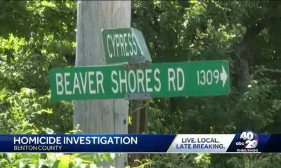
Man shot and killed in Benton County, near Rogers

Aiken County family fleeing to Mexico due to Trump immigration policies

Girls Hold Lemonade Stand for St. Jude Hospital | July 12, 2025 | News 19 at 10 p.m. – Weekend

Anti-ICE demonstrators march to Beaufort County Sheriff's Office

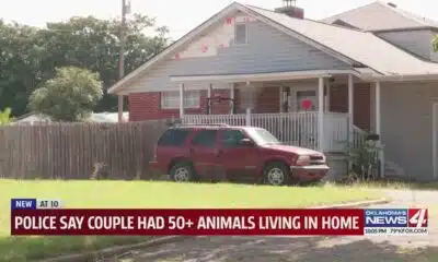
Police say couple had 50+ animals living in home

Coast judge upholds secrecy in politically charged case. Media appeals ruling.

Oyster spawning begins as MDMR-USM Hatchery Program enters production phase using mobile hatchery

Floods are swallowing their village. But for them and others, the EPA has cut the lifeline.

Newswatch anchor Serena Davanzo says goodbye to the viewers
Arrest made in school break-in, theft; another suspect still on the loose
WATCH LIVE | Friday Forecast

Alabama's Back-to-School Sales Tax Holiday returns: Which items are eligible

Christian's Morning Forecast: Strong Storms and Flood Watches Persist

Steps being taken to reopen parking garage at Harrison County Courthouse

Trump diagnosed with chronic ailment | FOX 5 News

Young photographer shoots for free, dedicated to his craft

Parking lot shoot out leaves 5 injured in Tower Grove South

Soaking rains finally moving out tonight

New prison would exacerbate Fort Smith’s current water transmission challenges
-

 News from the South - Tennessee News Feed5 days ago
Bread sold at Walmart, Kroger stores in TN, KY recalled over undeclared tree nut
-
News from the South - Arkansas News Feed7 days ago
Man shot and killed in Benton County, near Rogers
-
News from the South - Georgia News Feed1 day ago
Aiken County family fleeing to Mexico due to Trump immigration policies
-
News from the South - Alabama News Feed6 days ago
Girls Hold Lemonade Stand for St. Jude Hospital | July 12, 2025 | News 19 at 10 p.m. – Weekend
-
News from the South - Georgia News Feed7 days ago
Anti-ICE demonstrators march to Beaufort County Sheriff's Office
-
News from the South - Oklahoma News Feed7 days ago
Police say couple had 50+ animals living in home
-
Mississippi Today4 days ago
Coast judge upholds secrecy in politically charged case. Media appeals ruling.
-
Local News5 days ago
Oyster spawning begins as MDMR-USM Hatchery Program enters production phase using mobile hatchery