News from the South - Louisiana News Feed
New inspections urged for local bridges in Louisiana
SUMMARY: Following the catastrophic collapse of the Francis Key Bridge in Baltimore, a federal report calls for inspections of several bridges in Louisiana. The National Transportation Safety Board emphasizes the need to assess bridges, especially those over navigable waterways, to evaluate their vulnerability to collisions with large vessels. Key bridges flagged include the Huey P. Long, Greater New Orleans, and Crescent City Connection. Experts stress the importance of maintaining these structures to ensure commuter safety and prevent potential failures. Civil engineer Dr. Norma G.M. advocates for thorough vulnerability assessments to address any risks associated with these vital routes in Southeast Louisiana.
A Federal agency is calling for bridges across the country to be reviewed following the Baltimore bridge collapse.


News from the South - Louisiana News Feed
Saturday 10 PM Tropics Update: One far-off tropical wave to watch
SUMMARY: A tropical wave near Africa is emerging over the Atlantic but remains disorganized. The National Hurricane Center gives it a 60% chance to develop into a depression or tropical storm, possibly becoming Gabrielle. This system may move northward, staying over the open Atlantic and away from the Gulf, posing no immediate threat. Since the last named storm in late August, stable air, dry conditions, and increased wind shear have suppressed tropical activity in the Atlantic. The next storm names are Gabrielle, Humberto, and Imelda, with only the current wave showing potential for development at this time.
Meteorologist Alexandra Cranford tracks a lone disturbance with a chance of development on Saturday night, September 13, 2025.
News from the South - Louisiana News Feed
Haynes wanted in on Wildlife bribery scheme too, informant says
SUMMARY: Dusty Guidry, a former consultant who pleaded guilty to accepting $800,000 in bribes, testified that Assistant District Attorney Gary Haynes sought involvement in a bribery scheme at the Louisiana Department of Wildlife & Fisheries. Haynes, on trial for conspiracy, bribery, money laundering, and obstruction, was previously appointed to run Lafayette’s pretrial diversion program after supporting DA Don Landry. Guidry revealed Haynes pressured him to include him in a similar diversion program scheme at Wildlife & Fisheries, receiving checks totaling $90,000. The scheme involved splitting bribes among Guidry, vendor Leonard Franques, and former department secretary Jack Montoucet, who has also been charged. The statewide program never launched.
Read the full article
The post Haynes wanted in on Wildlife bribery scheme too, informant says appeared first on thecurrentla.com
SUMMARY: The Ouachita Parish Police Jury is conducting a series of community meetings to gather public input for their comprehensive plan guiding future growth. Police Jury members, including Larry Bratton from District D, emphasize the importance of reflecting residents’ voices in the master plan. Community members participated in interactive stations, allocating resources to priorities like infrastructure and downtown development, to help shape goals for the next 2, 5, and 20 years. Landscape architect Matt Pizatella and partners from Atlas support the effort. Bratton stresses that without proactive planning, the parish risks costly and less beneficial outcomes in the long term.
OPPJ Comprehensive Plan

A Sanctuary in Goodman: The Magic of the Public Library

Hyde-Smith, Warnock team up to recognize Gold Star Families Remembrance Week

FDA takes aim at Hims and other telehealth services in drug advertising blitz

Harrison County approves budget with no tax increase

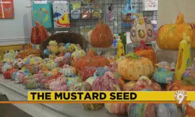
The Mustard Seed

Mississippi well-represented with pair of players featured in SEC weekly honors

DNA evidence found near scene of Charlie Kirk’s shooting matches suspect, FBI director says

Family of Curious George Creators to Visit de Grummond in Hattiesburg

WXXV Game of the Week: Week 3

Jackson State alum Tramell Tillman wins Emmy for ‘Severance’ role

Group in lawsuit say Franklin county prison land was bought before it was inspected

Lexington man accused of carjacking, firing gun during police chase faces federal firearm charge

California mother says daughter killed herself after being transitioned by school | California

Arkansas medical marijuana sales on pace for record year

What we know about Charlie Kirk shooting suspect, how he was caught

Local, statewide officials react to Charlie Kirk death after shooting in Utah
US stocks inch to more records as inflation slows and Oracle soars

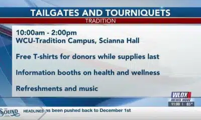
William Carey University holds 'tailgates and tourniquets' blood drive

Zaxby's Player of the Week: Dylan Jackson, Vigor WR

What fans can expect at Bourbon and Beyond with new layout, added features
Harrison County approves budget with no tax increase
The Mustard Seed
WXXV Game of the Week: Week 3

White House officials hold prayer vigil for Charlie Kirk

Jonesboro band culture responsible for global legacy | FOX 5

Family, friends hold candlelight vigil in honor of Giovanni Pelletier

Manhunt ends with arrest, new charges for alleged child killer | FOX 5 News

A look at recent flooding across South Florida

Ohio neighborhood fears landslide as retaining wall slips

Summer like temperatures continue
-

 News from the South - Arkansas News Feed7 days ago
Group in lawsuit say Franklin county prison land was bought before it was inspected
-
News from the South - Kentucky News Feed6 days ago
Lexington man accused of carjacking, firing gun during police chase faces federal firearm charge
-
 The Center Square7 days ago
California mother says daughter killed herself after being transitioned by school | California
-
News from the South - Arkansas News Feed6 days ago
Arkansas medical marijuana sales on pace for record year
-
News from the South - North Carolina News Feed4 days ago
What we know about Charlie Kirk shooting suspect, how he was caught
-
News from the South - Missouri News Feed6 days ago
Local, statewide officials react to Charlie Kirk death after shooting in Utah
-
Local News6 days ago
US stocks inch to more records as inflation slows and Oracle soars
-
Local News Video6 days ago
William Carey University holds 'tailgates and tourniquets' blood drive