News from the South - Louisiana News Feed
Monday 12 pm Tropical Update: Tropical Depression 18 forms, Louisiana in the cone
SUMMARY: A tropical depression is currently forming in the Caribbean and may strengthen into a tropical storm, Raphael, as it approaches Cuba and later the Gulf of Mexico. While conditions will be less favorable in the Gulf, the storm is expected to weaken significantly by the end of the week due to drier air, cooler temperatures, and increased wind shear. Rainfall in the New Orleans area could total around one to two inches, bringing much-needed precipitation after a dry spell. Residents are advised to stay updated, as forecasts may change. Overall, there is no immediate concern.
The forecast this week includes a lot to talk about, with daily chances for rain and a developing hurricane heading into the southern Gulf of Mexico.
First, we start our week off warm and humid, with a few showers around each day. If you’re heading to vote on Tuesday, make sure you have an umbrella just in case you run into a shower.
For the rest of the week, we’ll be watching The Tropics. A developing storm is moving through the Caribbean Monday morning. The system, likely to get the name Rafael, will move toward Cuba by Wednesday as a hurricane. The storm will enter the Gulf of Mexico around Wednesday, likely as a hurricane. Luckily it’s November, so we do think the storm will begin to weaken as it moves north in the Gulf. This is thanks to dry air, stronger wind shear, and cooler ocean temperatures.
The current track does bring the storm near Louisiana and Mississippi Friday into Saturday, but there remains a lot of uncertainty on how strong the storm will be once it nears the northern Gulf. If it weakens fast enough, there might not be much left of it that can have an impact. Based on the current forecast, our concern level remains very low, although we could see some rain and stronger winds. Follow the forecast closely through the week to see if there are any big changes.


News from the South - Louisiana News Feed
Haynes wanted in on Wildlife bribery scheme too, informant says
SUMMARY: Dusty Guidry, a former consultant who pleaded guilty to accepting $800,000 in bribes, testified that Assistant District Attorney Gary Haynes sought involvement in a bribery scheme at the Louisiana Department of Wildlife & Fisheries. Haynes, on trial for conspiracy, bribery, money laundering, and obstruction, was previously appointed to run Lafayette’s pretrial diversion program after supporting DA Don Landry. Guidry revealed Haynes pressured him to include him in a similar diversion program scheme at Wildlife & Fisheries, receiving checks totaling $90,000. The scheme involved splitting bribes among Guidry, vendor Leonard Franques, and former department secretary Jack Montoucet, who has also been charged. The statewide program never launched.
Read the full article
The post Haynes wanted in on Wildlife bribery scheme too, informant says appeared first on thecurrentla.com
SUMMARY: The Ouachita Parish Police Jury is conducting a series of community meetings to gather public input for their comprehensive plan guiding future growth. Police Jury members, including Larry Bratton from District D, emphasize the importance of reflecting residents’ voices in the master plan. Community members participated in interactive stations, allocating resources to priorities like infrastructure and downtown development, to help shape goals for the next 2, 5, and 20 years. Landscape architect Matt Pizatella and partners from Atlas support the effort. Bratton stresses that without proactive planning, the parish risks costly and less beneficial outcomes in the long term.
OPPJ Comprehensive Plan
News from the South - Louisiana News Feed
Mayor Cantrell pleads not guilty to federal corruption charges; judge imposes travel restrictions
SUMMARY: Mayor Latoya Cantrell pleaded not guilty to 11 federal charges including conspiracy, fraud, obstruction, and making false statements. The indictment links an alleged affair with her police bodyguard, Officer Vappy, to misuse of city funds and efforts to conceal deleted encrypted WhatsApp messages. Although no personal financial benefit is claimed, the charges accuse Cantrell of arranging unnecessary protective details for Vappy, costing taxpayers $70,000. Released without bond, Cantrell must surrender her passport, requires approval for travel outside Louisiana, and is barred from discussing the case with city employees or Vappy. Despite restrictions, court rules her ability to manage city operations remains unaffected.
Cantrell was indicted by a grand jury Aug. 15 as additional charges tacked onto Vappie’s indictment from 2024.

Screech Owls – Small but Cute

Trump calls on all NATO countries to stop buying Russian oil, threatens 50% to 100% tariffs on China

Austin becoming FEMA-approved emergency alert authority, planning 1st test alert

New findings by NASA Mars rover provide strongest hints yet of potential signs of ancient life

Burlington opening 60 new stores in 26 states, including TN: Here's where

Florida man who killed 2 women set for lethal injection next month, extending execution record

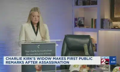
Charlie Kirk's widow makes first public remarks

La Niña now expected to last all winter

Florence man sentenced to life in prison for killing girlfriend

Is nail gel actually harmful? It's complicated

Reagan era credit pumps billions into North Carolina housing | North Carolina

Amid opposition to Blount County medical waste facility, a mysterious Facebook page weighs in

South Carolina’s Tess Ferm Wins Miss America’s Teen 2026

3 states push to put the Ten Commandments back in school – banking on new guidance at the Supreme Court

Duke University pilot project examining pros and cons of using artificial intelligence in college

1587 Prime gives first look at food, cocktail menu ahead of grand opening in KC

Protesters in D.C. flood the streets demanding an end to Trump’s military deployment

Powerball surges to $1.8B ahead of Saturday's drawing

On the record: Winsome Earle-Sears

Interview: Come see Baptist at WTVA Senior Health Fair
Charlie Kirk's widow makes first public remarks
Florence man sentenced to life in prison for killing girlfriend
Is nail gel actually harmful? It's complicated

High School football highlights: 9.12.25 (Part 1)

Few showers possible Saturday night into Sunday

South Florida to see less showers in the coming days

Erika Kirks delivers fist remarks on husband Charlie Kirk's death: 'I will not your legacy die'

NW Arkansas Championship expected to bring money to Rogers

Watch out for 'fly-by-night' contractors

What we know about Charlie Kirk shooting suspect, how he was caught
-

 News from the South - North Carolina News Feed7 days ago
Reagan era credit pumps billions into North Carolina housing | North Carolina
-
 News from the South - Alabama News Feed7 days ago
Amid opposition to Blount County medical waste facility, a mysterious Facebook page weighs in
-
News from the South - South Carolina News Feed6 days ago
South Carolina’s Tess Ferm Wins Miss America’s Teen 2026
-
News from the South - Kentucky News Feed6 days ago
3 states push to put the Ten Commandments back in school – banking on new guidance at the Supreme Court
-
Local News6 days ago
Duke University pilot project examining pros and cons of using artificial intelligence in college
-
News from the South - West Virginia News Feed5 days ago
Protesters in D.C. flood the streets demanding an end to Trump’s military deployment
-
News from the South - Missouri News Feed5 days ago
1587 Prime gives first look at food, cocktail menu ahead of grand opening in KC
-
News from the South - North Carolina News Feed7 days ago
Powerball surges to $1.8B ahead of Saturday's drawing