Local News Video
Meteorologist Trey Tonnessen: “Calm Before Storm” 10PM Forecast
SUMMARY: The Weather Authority reports stable conditions for the evening that are expected to continue overnight. However, a change is coming next week with cloudy, rainy, and stormy weather expected. Current conditions show upper 60s temperatures along the coast, slightly cooler further north. Winds are light, from the northeast at 3-5 mph. A significant increase in wind gusts early next week suggests a frontal system is approaching. A weak front on Saturday morning won’t have much impact, but a different system early next week could bring severe thunderstorms, capitalizing on necessary atmospheric conditions. The focus for severe weather potential is on Tuesday, with expected rainfall and lightning.
Friday November 17th, 2023: A weak cold front and upper level trough will begin to move toward
our region late tonight and early Saturday. Ahead of the front we may see
patchy fog where low level moisture pooling takes place. However, with
limited radiative processes and eventually dry air advecting in behind
the front, Visibility will drop like it would otherwise.

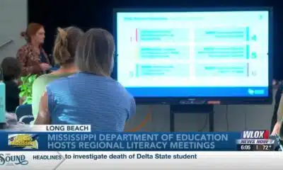


SUMMARY: The Mississippi Department of Education is hosting a series of statewide literacy meetings this month to improve reading skills and family engagement. One meeting took place at Reeves Elementary in Long Beach, aiming to review Mississippi’s Literacy-Based Promotion Act, a 2013 state law promoting comprehensive reading instruction for children. The department and Long Beach School District emphasize the importance of involving families in this process, as a solid literacy foundation benefits children’s lifelong learning and fluency. These meetings provide an opportunity to equip parents with effective tools to support their children’s literacy development and overall success in education and life.
The Mississippi Department of Education is hosting a series of literacy meetings across the state this month.
For more Local News from WLOX: https://www.wlox.com/
For more YouTube Content: https://www.youtube.com/channel/UCQZgBHlQMqHUV_hf4_9jLLQ
Local News Video
Saints Report: Saints lose another close game this time in week two against the San Francisco 49ers
SUMMARY: The New Orleans Saints lost a close game in week two against the San Francisco 49ers, 26-21, at the Caesar Superdome. Despite missing key 49ers players, the Saints struggled early but fought back with touchdowns by Rasheed Shahid and Devon Ble. A critical fourth-down sack of Spencer Rattler sealed their fate. Coach Kell Moore praised the team’s effort but emphasized the need for better situational play and seizing opportunities. The Saints aim to improve as they prepare to face the Seattle Seahawks next Sunday, September 21st. Reporting from the Caesar Superdome, Ever Gier Jr., WXXV News25 Sports.
SUMMARY: Harrison County leaders have finalized and approved the 2025-2026 fiscal budget with no tax increase, balancing expenditures at around $324 million. The Board of Supervisors completed budget talks and passed the budget before the October 1st deadline. Board President Nathan Barrett confirmed there will be no increases in the county’s tax levies. However, the Harrison County School District will implement a small, state-required increase in their school tax, which is a formality and expected to have minimal impact on taxpayers. Overall, the county’s budget remains stable without additional fiscal burdens on residents.
The Board of Supervisors passed the 2025-2026 fiscal budget on Monday. For more Local News from WLOX: …

Prosecutors already have dropped nearly a dozen cases from Trump’s DC crime surge, judge says

Statewide literacy meetings aim to boost reading skills and family engagement
Rep. Bennie Thompson calling on federal investigation into Delta State student’s death

A Sanctuary in Goodman: The Magic of the Public Library

Suspect in Charlie Kirk killing is charged with murder as prosecutor says DNA found on rifle trigger

Hyde-Smith, Warnock team up to recognize Gold Star Families Remembrance Week

FDA takes aim at Hims and other telehealth services in drug advertising blitz

Saints Report: Saints lose another close game this time in week two against the San Francisco 49ers

Harrison County approves budget with no tax increase

‘Little quiet light’: Family remembers Delta State University student found dead on campus

Lexington man accused of carjacking, firing gun during police chase faces federal firearm charge

Zaxby's Player of the Week: Dylan Jackson, Vigor WR

Arkansas medical marijuana sales on pace for record year

What we know about Charlie Kirk shooting suspect, how he was caught

Local, statewide officials react to Charlie Kirk death after shooting in Utah

US stocks inch to more records as inflation slows and Oracle soars

Introducing our WXXV Student Athlete of the Week, St. Patrick’s Parker Talley!

Russian drone incursion in Poland prompts NATO leaders to take stock of bigger threats

Federal hate crime charge sought in Charlotte stabbing | North Carolina

Weapon recovered as manhunt continues in Kirk assassination investigation | National
Statewide literacy meetings aim to boost reading skills and family engagement
Saints Report: Saints lose another close game this time in week two against the San Francisco 49ers
Harrison County approves budget with no tax increase
‘Little quiet light’: Family remembers Delta State University student found dead on campus

The Mustard Seed

WXXV Game of the Week: Week 3

White House officials hold prayer vigil for Charlie Kirk

Jonesboro band culture responsible for global legacy | FOX 5

Family, friends hold candlelight vigil in honor of Giovanni Pelletier

Manhunt ends with arrest, new charges for alleged child killer | FOX 5 News
-

 News from the South - Kentucky News Feed7 days ago
Lexington man accused of carjacking, firing gun during police chase faces federal firearm charge
-
News from the South - Alabama News Feed7 days ago
Zaxby's Player of the Week: Dylan Jackson, Vigor WR
-
News from the South - Arkansas News Feed7 days ago
Arkansas medical marijuana sales on pace for record year
-
News from the South - North Carolina News Feed5 days ago
What we know about Charlie Kirk shooting suspect, how he was caught
-
News from the South - Missouri News Feed7 days ago
Local, statewide officials react to Charlie Kirk death after shooting in Utah
-
Local News7 days ago
US stocks inch to more records as inflation slows and Oracle soars
-
Local News Video6 days ago
Introducing our WXXV Student Athlete of the Week, St. Patrick’s Parker Talley!
-
Local News6 days ago
Russian drone incursion in Poland prompts NATO leaders to take stock of bigger threats