News from the South - West Virginia News Feed
Katie Frazier’s Sunday June 15th Forecast
SUMMARY: Katie Frazier’s June 15th forecast warns of ongoing rain and flash flood potential across southern West Virginia, especially for the northern counties under a flash flood watch. Rain has already impacted areas like Bluefield, Richlands, and War. The region faces a Level 2 of 4 flash flood threat, with risks continuing through Tuesday and possibly into Thursday. Rainfall may total 2–5 inches in some areas. Temperatures will stay seasonally warm, with highs in the 70s for places like Fayetteville, Oak Hill, Beckley, and Bluefield. Daily storm chances persist, with severe weather possible by Tuesday and Thursday. Caution is urged.
FOLLOW US ON FACEBOOK AND TWITTER:
https://facebook.com/WOAYNewsWatch
https://twitter.com/WOAYNewsWatch


News from the South - West Virginia News Feed
Ohio neighborhood fears landslide as retaining wall slips
SUMMARY: In Portsmouth, Ohio, a retaining wall has been slipping for about five years, causing fear among residents like the Yuri family who moved in just before the slip began. Despite support beams installed two years ago, cracks in the wall allow water to gush through, flooding parts of the road and raising concerns about a potential catastrophic landslide. Local councilman Shawn Dun highlights questions about the wall’s stability and estimates repair costs near $2 million, with the city seeking grants to fund the work. Residents anxiously await repairs, hoping the problem will be resolved soon to prevent disaster.
A cloud of concern hovers over one Portsmouth neighborhood. Those living along Richardson Road wonder how much longer a retaining wall will hold and keep a hillside from sliding that would damage their property. The support wall began slipping 5 years ago. A couple years later, support beams were put in place for a problem that those living along the street say is a ticking time bomb.
FULL STORY: https://wchstv.com/news/local/a-ticking-time-bomb-has-a-portsmouth-neighborhood-living-in-fear
_________________________________________
For the latest local and national news, visit our website: https://wchstv.com/
Sign up for our newsletter: https://wchstv.com/sign-up
Follow WCHS-TV on social media:
Facebook: https://www.facebook.com/eyewitnessnewscharleston/
Twitter: https://twitter.com/wchs8fox11
Instagram: https://www.instagram.com/wchs8fox11/
News from the South - West Virginia News Feed
Christian's Latest Forecast: More Dry Days; Rain Potential Late Next Week
SUMMARY: Storm Watch meteorologist Christian Boler reports mild, mostly dry weather continuing through the weekend with temperatures around 80°F and partly cloudy skies. A high-pressure system will maintain these warm, dry conditions into early next week. Some unorganized tropical rainstorms may bring isolated showers from Tuesday night into Wednesday morning, followed by a dry midweek. Saturday promises significant rainfall, helping to relieve recent dry and minor drought conditions affecting vegetation. Temperatures have shifted from below to above average this week but will dip below average later in the month. Overall, expect more dry days with rain potential late next week, improving moisture levels regionally.
FOLLOW US ON FACEBOOK AND TWITTER: https://facebook.com/WOAYNewsWatch https://twitter.com/WOAYNewsWatch.
News from the South - West Virginia News Feed
Road-widening project gets completion date, property issues remain unclear
SUMMARY: The Cross Lanes road-widening project, expanding Route 622 from Golf Mountain Road to Route 62 near Andrew Jackson Middle School, has resumed after a ten-month pause. Originally set for completion in June 2025, the new completion date is February 2027 due to delays caused by utility pole relocations. Construction is causing traffic congestion, especially around the Kroger turning light, which is being studied for timing adjustments. Despite frustrations, officials emphasize the long-term benefits. Property issues, including damage claims and easements, remain unresolved. Kanawha County lawmakers continue to provide updates as the project progresses.
Source

Who qualifies for ‘no tax on tips’ and what counts as a tip? Here are the new rules

Prosecutor says stalking suspect ambushed Pennsylvania police officers, killing 3

Pops in the Park Returns October 7

Biloxi Shuckers eliminated from 2025 playoffs by Montgomery

Morning ‘Sip: Red Carpet Bowl

Events happening this weekend in Mississippi: September 19-21

Intel’s best day since the 1980s helps drive Wall Street to more records

Man dies after riding roller coaster at new Florida amusement park Epic Universe

NCAA eliminates spring transfer period for football

Curtains Up: Theatre MSU Unveils Season of Classics, Musicals

Screech Owls – Small but Cute
New findings by NASA Mars rover provide strongest hints yet of potential signs of ancient life

What are data centers and why do they matter? | National

Rolling Through History: The Comfort and Culture of Dumplings

Steven Spielberg celebrates ‘awesome’ 50th anniversary ‘Jaws’ exhibition at Academy Museum

DNA evidence found near scene of Charlie Kirk’s shooting matches suspect, FBI director says

Orlando restaurant owner invites artists to parking lot amid federal fight against street art

Summer like temperatures continue

White House officials hold prayer vigil for Charlie Kirk

Hyde-Smith, Warnock team up to recognize Gold Star Families Remembrance Week
Morning ‘Sip: Red Carpet Bowl

15-minute parking spots added in downtown Gulfport to ease congestion during renovations

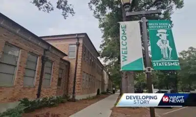
Family of Delta State student found hanging seeks answers

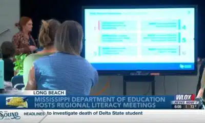
Statewide literacy meetings aim to boost reading skills and family engagement

Pet of the Week: Destiny is looking for a forever home!

Saints Report: Saints lose another close game this time in week two against the San Francisco 49ers

Harrison County approves budget with no tax increase

‘Little quiet light’: Family remembers Delta State University student found dead on campus

The Mustard Seed

WXXV Game of the Week: Week 3
-

 Our Mississippi Home7 days ago
Screech Owls – Small but Cute
-
Local News7 days ago
New findings by NASA Mars rover provide strongest hints yet of potential signs of ancient life
-
 The Center Square6 days ago
What are data centers and why do they matter? | National
-
Our Mississippi Home6 days ago
Rolling Through History: The Comfort and Culture of Dumplings
-

 Local News6 days ago
Steven Spielberg celebrates ‘awesome’ 50th anniversary ‘Jaws’ exhibition at Academy Museum
-
Local News5 days ago
DNA evidence found near scene of Charlie Kirk’s shooting matches suspect, FBI director says
-
News from the South - Florida News Feed5 days ago
Orlando restaurant owner invites artists to parking lot amid federal fight against street art
-
Mississippi News Video6 days ago
Summer like temperatures continue