News from the South - North Carolina News Feed
Helene Aftermath: How organizations are helping those impacted
SUMMARY: The community in Durham is actively supporting Western North Carolina residents affected by recent disasters by donating goods at 24-hour Towing on Hillsboro Road. Locals have been contributing throughout the day, packing donations into a tractor trailer for delivery. Lee Gardner, the towing company owner, noted the severity of the situation, stating it eclipses previous storms he’s encountered. The Durham Rescue Mission is also involved, organizing donations for those unable to access basic necessities due to power outages and closed roads. Coverage of the relief efforts and ways to assist will be available on the ABC11 website.
Helene may be past North Carolina, but its impact is still being felt.


News from the South - North Carolina News Feed
White House officials hold prayer vigil for Charlie Kirk
SUMMARY: Republican lawmakers, conservative leaders, and Trump administration officials held a prayer vigil and memorial at the Kennedy Center honoring slain activist Charlie Kirk, founder of Turning Point USA. Kirk was killed in Utah, where memorials continue at Utah Valley University and Turning Point USA’s headquarters. Police say 22-year-old Tyler Robinson turned himself in but has not confessed or cooperated. Robinson’s roommate, his boyfriend who is transitioning, is cooperating with authorities. Investigators are examining messages Robinson allegedly sent on Discord joking about the shooting. Robinson faces charges including aggravated murder, obstruction of justice, and felony firearm discharge.
White House officials and Republican lawmakers gathered at the Kennedy Center at 6 p.m. to hold a prayer vigil in remembrance of conservative activist Charlie Kirk.
https://abc11.com/us-world/
Download: https://abc11.com/apps/
Like us on Facebook: https://www.facebook.com/ABC11/
Instagram: https://www.instagram.com/abc11_wtvd/
Threads: https://www.threads.net/@abc11_wtvd
TIKTOK: https://www.tiktok.com/@abc11_eyewitnessnews
News from the South - North Carolina News Feed
Family, friends hold candlelight vigil in honor of Giovanni Pelletier
SUMMARY: Family and friends held a candlelight vigil in Apex to honor Giovanni Pelletier, a Fuquay Varina High School graduate whose body was found last month in a Florida retention pond. Giovanni went missing while visiting family, after reportedly acting erratically and leaving his cousins’ car. Loved ones remembered his infectious smile, laughter, and loyal friendship, expressing how deeply he impacted their lives. His mother shared the family’s ongoing grief and search for answers as authorities continue investigating his death. Despite the sadness, the community’s support has provided comfort. A celebration of life mass is planned in Apex to further commemorate Giovanni’s memory.
“It’s good to know how loved someone is in their community.”
More: https://abc11.com/post/giovanni-pelletier-family-friends-hold-candlelight-vigil-honor-wake-teen-found-dead-florida/17811995/
Download: https://abc11.com/apps/
Like us on Facebook: https://www.facebook.com/ABC11/
Instagram: https://www.instagram.com/abc11_wtvd/
Threads: https://www.threads.net/@abc11_wtvd
TIKTOK: https://www.tiktok.com/@abc11_eyewitnessnews
SUMMARY: The North Carolina Courage defeated Angel City FC 2-1 in Cary, ending their unbeaten streak. Monaca scored early at the 6th minute, followed by Bull City native Brianna Pinto’s goal at the 18th minute, securing a 2-0 halftime lead. Angel City intensified in the second half, scoring in the 88th minute, but the Courage held firm defensively to claim victory. Pinto expressed pride in the win, emphasizing the team’s unity and playoff ambitions. Nearly 8,000 fans attended. Coverage continues tonight at 11, alongside college football updates, including the Tar Heels vs. Richmond game live from Chapel Hill.
Saturday’s win was crucial for the Courage as the regular season starts to wind down.
https://abc11.com/post/north-carolina-courage-wins-2-1-angel-city-fc/17810234/
Download: https://abc11.com/apps/
Like us on Facebook: https://www.facebook.com/ABC11/
Instagram: https://www.instagram.com/abc11_wtvd/
Threads: https://www.threads.net/@abc11_wtvd
TIKTOK: https://www.tiktok.com/@abc11_eyewitnessnews

NCAA eliminates spring transfer period for football

Curtains Up: Theatre MSU Unveils Season of Classics, Musicals

US stocks churn amid uncertainty about how many more rate cuts are coming from the Fed
The Sound of the South: Mississippi’s Songbook

Prosecutors already have dropped nearly a dozen cases from Trump’s DC crime surge, judge says

15-minute parking spots added in downtown Gulfport to ease congestion during renovations

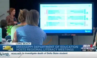
Statewide literacy meetings aim to boost reading skills and family engagement
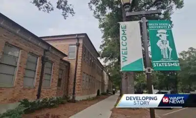
Rep. Bennie Thompson calling on federal investigation into Delta State student’s death

A Sanctuary in Goodman: The Magic of the Public Library

Suspect in Charlie Kirk killing is charged with murder as prosecutor says DNA found on rifle trigger

What we know about Charlie Kirk shooting suspect, how he was caught

Federal hate crime charge sought in Charlotte stabbing | North Carolina

Screech Owls – Small but Cute

NW Arkansas Championship expected to bring money to Rogers

Under pressure, some immigrants are leaving American dreams behind

Mississippi Science Fest showcases STEAM events, activities

CBS Miami highlights free mammogram program with mobile mammovan

Safe Central Texas meet-up spots for online purchases

What to know about Trump’s National Guard deployment to Memphis

Russia and Belarus launch military exercise that fueled Western concerns
15-minute parking spots added in downtown Gulfport to ease congestion during renovations
Statewide literacy meetings aim to boost reading skills and family engagement

Saints Report: Saints lose another close game this time in week two against the San Francisco 49ers

Harrison County approves budget with no tax increase

‘Little quiet light’: Family remembers Delta State University student found dead on campus

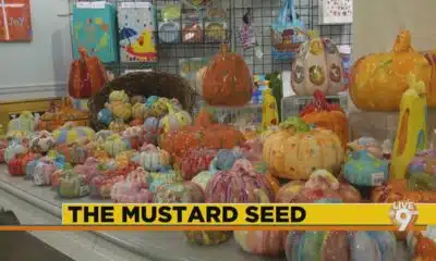
The Mustard Seed

WXXV Game of the Week: Week 3

White House officials hold prayer vigil for Charlie Kirk

Jonesboro band culture responsible for global legacy | FOX 5

Family, friends hold candlelight vigil in honor of Giovanni Pelletier
-

 News from the South - North Carolina News Feed6 days ago
What we know about Charlie Kirk shooting suspect, how he was caught
-
 News from the South - North Carolina News Feed7 days ago
Federal hate crime charge sought in Charlotte stabbing | North Carolina
-
Our Mississippi Home5 days ago
Screech Owls – Small but Cute
-
News from the South - Arkansas News Feed6 days ago
NW Arkansas Championship expected to bring money to Rogers
-
News from the South - North Carolina News Feed7 days ago
Under pressure, some immigrants are leaving American dreams behind
-
Mississippi News Video7 days ago
Mississippi Science Fest showcases STEAM events, activities
-
News from the South - Florida News Feed7 days ago
CBS Miami highlights free mammogram program with mobile mammovan
-
News from the South - Texas News Feed7 days ago
Safe Central Texas meet-up spots for online purchases