Local News Video
FIRST ALERT: Sunshine and 70s today, expect stormy weather this weekend (03/11/2025)
SUMMARY: Today in South Mississippi, expect sunshine and temperatures climbing into the low to mid-70s, following a chilly morning. The clear skies make for a perfect outdoor day, but conditions may change this weekend as stormy weather approaches. A significant chance of severe thunderstorms is forecasted for Saturday due to an area of low pressure and a cold front, particularly affecting Mississippi, Alabama, and Georgia. Rainfall could reach 2 to 4 inches in some areas, with potential for strong winds and hail. After the storms, a more pleasant Sunday is anticipated before cooler air returns next week.
Meteorologist Taylor Graham details the sunshine today with highs in the low to mid 70s. Plus, a look ahead to the stormy forecast this weekend.


SUMMARY: On this Thursday evening at the Silver Slipper Casino, skies are mostly clear with some passing clouds and a little more humidity than yesterday. Coastal temperatures are in the upper 80s, rising to the mid-90s inland, such as 94 at Wiggins. Winds from the south are steady at 10 mph along the coast, bringing Gulf moisture and higher dew points, making overnight temperatures warmer in the upper 60s to mid-70s. Light scattered showers possible tonight, with southern winds returning tomorrow, keeping highs in the low to mid-90s. Cloud cover will increase Saturday ahead of a cold front bringing isolated showers Sunday and Monday, then cooler temperatures with highs in the mid-80s.
SUMMARY: The search continues for Tyler Bell, the suspect wanted in connection to a bank robbery at Hancock Whitney Bank on D’Iberville Boulevard. The robbery occurred just before 3 p.m. Bell initially entered the bank asking to use the bathroom but was denied and left. Shortly after, he returned, handed a teller a note demanding money, and received an unknown amount before fleeing. Police received conflicting reports about his escape, with some saying he ran on foot and others that he drove away. Surveillance footage is still being reviewed. Authorities urge anyone with information to come forward as the investigation develops.
D’Iberville bank robbery suspect still on the run, officials say
For more Local News from WLOX: https://www.wlox.com/
For more YouTube Content: https://www.youtube.com/channel/UCQZgBHlQMqHUV_hf4_9jLLQ
SUMMARY: South Mississippi will experience pleasant mornings with temperatures in the 60s and 70s, followed by hot afternoons reaching the 90s. Tonight is quiet and comfortable, with light south winds and no significant weather activity. A dip in the jet stream brings cooler, drier air and wind shear, limiting tropical activity in the Gulf. Rain chances are low, with only stray showers possible. Water conditions are calm with northwest to southeast winds at 5-10 knots and seas 1-2 feet. The Atlantic has a high chance of tropical development, but it is expected to stay away from the Gulf, posing more concern for the East Coast.
Chief Meteorlogist Eric Jeansonne explains why relief from the summer heat may come during the earlier hours of the day.

Mississippi State fined $500K after storming field in celebration of win over Arizona State

NY AG steps into legal fight over abortion pills, shield law

Family of Nashville woman killed in shooting seeks help laying her to rest

Michael Owens found guilty of killing wife in 2023

Florida’s Brendan Bett planning to apologize to USF player he spit at after loss

1587 Prime gives first look at food, cocktail menu ahead of grand opening in KC

Interview: Come see Baptist at WTVA Senior Health Fair

Ariana Grande, Lady Gaga shine at MTV VMAs with wins and performances

Arrests, recoveries made during state-wide operations tackling sex offenders, missing children

Two girls, 3 and 6, and two teens shot after gunmen opened fire on Memphis home, police say

Tennessee ranks near the top for ICE arrests

Trump proposed getting rid of FEMA, but his review council seems focused on reforming the agency

Texas high school football scores for Thursday, Sept. 4

Brandon residents want answers, guarantees about data center

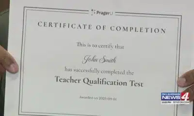
Test taker finds it's impossible to fail 'woke' teacher assessment

What is AI slop? A technologist explains this new and largely unwelcome form of online content

Every fall there’s a government shutdown warning. This time it could happen.

Pre-Fall Fun in Mississippi | Our Mississippi Home

Southern Miss Faculty and Student Contribute to Groundbreaking NOAA-Funded Plastic Cleanup

Hackett student arrested after shooting threat
Michael Owens found guilty of killing wife in 2023
Interview: Come see Baptist at WTVA Senior Health Fair
Two girls, 3 and 6, and two teens shot after gunmen opened fire on Memphis home, police say

Several killed in Jerusalem bus station shooting, police say

President Trump talks about Georgia ICE raid

Trump threatens to send National Guard troops, immigration agents to Chicago

NBC 10 News Today: LSU female drum major

Orlando bar employee arrested after allegedly stabbing patron 10 times over tab

Officials to outline new details in 45-year-old cold case

Could AI tech help you find your perfect match? This Miami app founder hopes so
-

 News from the South - Tennessee News Feed7 days ago
Tennessee ranks near the top for ICE arrests
-
Mississippi Today6 days ago
Trump proposed getting rid of FEMA, but his review council seems focused on reforming the agency
-
News from the South - Texas News Feed4 days ago
Texas high school football scores for Thursday, Sept. 4
-
Mississippi Today6 days ago
Brandon residents want answers, guarantees about data center
-
News from the South - Oklahoma News Feed7 days ago
Test taker finds it's impossible to fail 'woke' teacher assessment
-
The Conversation7 days ago
What is AI slop? A technologist explains this new and largely unwelcome form of online content
-
News from the South - Arkansas News Feed7 days ago
Every fall there’s a government shutdown warning. This time it could happen.
-
Our Mississippi Home7 days ago
Pre-Fall Fun in Mississippi | Our Mississippi Home