Local News Video
1/9 – Trey Tonnessen's “Sliding High Pressure” Tuesday Night Forecast
SUMMARY: The weather is cold and unusual for this time of year, with temperatures dropping into the 30s and feeling like the 20s overnight. The Gulf Coast has seen rainfall averages of 2-2.5 inches, with higher amounts further north and east. Wind gusts of 75-80 mph are expected in some areas, and a high pressure system will bring stability for the next day and a half before clouds return later in the week. A storm system is expected on Friday, with a severe weather outlook. It is advised to be prepared and stay safe. Also, there is a discussion about the National Championship.
Here on the Mississippi Gulf Coast, we will have one and a half days of drier weather; before another system will move through the area Thursday night into Friday morning. Southerly surface winds will help to return warm, humid, and moist air back into the environment ahead of that system. If enough return flow occurs, we will be looking at the possibility of severe weather for our area. Currently, it looks like there will be sufficient moisture and instability. As of now, Storm Prediction Center has placed us in a slight risk (level 2/5) for severe weather. The main threats would likely be strong damaging winds and maybe a tornado or two.


Local News Video
15-minute parking spots added in downtown Gulfport to ease congestion during renovations
SUMMARY: In Gulfport, eight temporary 15-minute parking spots are being added near the Hancock Whitney Bank to reduce congestion during upcoming renovations. The bank building, located across Highway 49, is set to be renovated, though no official start date has been determined. City leaders hope these short-term parking spots will ease traffic by accommodating customers using the bank’s drive-thru, where parking is currently limited, especially at peak times. These spots will remain in place until the renovation work is finished, improving access for customers to enter and exit quickly while construction occurs in downtown Gulfport.
Eight 15-minute parking spots will be temporarily added at the Hancock Whitney Bank in Gulfport. For more Local News from …
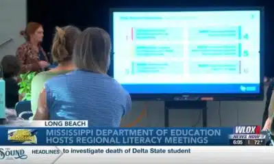
SUMMARY: The Mississippi Department of Education is hosting a series of statewide literacy meetings this month to improve reading skills and family engagement. One meeting took place at Reeves Elementary in Long Beach, aiming to review Mississippi’s Literacy-Based Promotion Act, a 2013 state law promoting comprehensive reading instruction for children. The department and Long Beach School District emphasize the importance of involving families in this process, as a solid literacy foundation benefits children’s lifelong learning and fluency. These meetings provide an opportunity to equip parents with effective tools to support their children’s literacy development and overall success in education and life.
The Mississippi Department of Education is hosting a series of literacy meetings across the state this month.
For more Local News from WLOX: https://www.wlox.com/
For more YouTube Content: https://www.youtube.com/channel/UCQZgBHlQMqHUV_hf4_9jLLQ
Local News Video
Saints Report: Saints lose another close game this time in week two against the San Francisco 49ers
SUMMARY: The New Orleans Saints lost a close game in week two against the San Francisco 49ers, 26-21, at the Caesar Superdome. Despite missing key 49ers players, the Saints struggled early but fought back with touchdowns by Rasheed Shahid and Devon Ble. A critical fourth-down sack of Spencer Rattler sealed their fate. Coach Kell Moore praised the team’s effort but emphasized the need for better situational play and seizing opportunities. The Saints aim to improve as they prepare to face the Seattle Seahawks next Sunday, September 21st. Reporting from the Caesar Superdome, Ever Gier Jr., WXXV News25 Sports.

NCAA eliminates spring transfer period for football

US stocks churn amid uncertainty about how many more rate cuts are coming from the Fed
The Sound of the South: Mississippi’s Songbook

Prosecutors already have dropped nearly a dozen cases from Trump’s DC crime surge, judge says

15-minute parking spots added in downtown Gulfport to ease congestion during renovations

Statewide literacy meetings aim to boost reading skills and family engagement
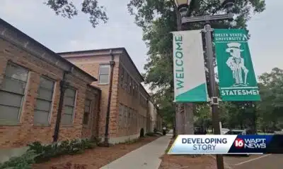
Rep. Bennie Thompson calling on federal investigation into Delta State student’s death

A Sanctuary in Goodman: The Magic of the Public Library

Suspect in Charlie Kirk killing is charged with murder as prosecutor says DNA found on rifle trigger

Hyde-Smith, Warnock team up to recognize Gold Star Families Remembrance Week

What we know about Charlie Kirk shooting suspect, how he was caught

Federal hate crime charge sought in Charlotte stabbing | North Carolina

Screech Owls – Small but Cute

NW Arkansas Championship expected to bring money to Rogers

Haynes wanted in on Wildlife bribery scheme too, informant says

Huntsville Fire & Rescue Holds 9/11 Memorial Service | Sept. 11, 2025 | News 19 at 5 p.m.

Under pressure, some immigrants are leaving American dreams behind

Mississippi Science Fest showcases STEAM events, activities

CBS Miami highlights free mammogram program with mobile mammovan

Safe Central Texas meet-up spots for online purchases
15-minute parking spots added in downtown Gulfport to ease congestion during renovations
Statewide literacy meetings aim to boost reading skills and family engagement

Saints Report: Saints lose another close game this time in week two against the San Francisco 49ers

Harrison County approves budget with no tax increase

‘Little quiet light’: Family remembers Delta State University student found dead on campus

The Mustard Seed

WXXV Game of the Week: Week 3

White House officials hold prayer vigil for Charlie Kirk

Jonesboro band culture responsible for global legacy | FOX 5

Family, friends hold candlelight vigil in honor of Giovanni Pelletier
-

 News from the South - North Carolina News Feed6 days ago
What we know about Charlie Kirk shooting suspect, how he was caught
-
 News from the South - North Carolina News Feed6 days ago
Federal hate crime charge sought in Charlotte stabbing | North Carolina
-
Our Mississippi Home5 days ago
Screech Owls – Small but Cute
-
News from the South - Arkansas News Feed6 days ago
NW Arkansas Championship expected to bring money to Rogers
-
News from the South - Louisiana News Feed7 days ago
Haynes wanted in on Wildlife bribery scheme too, informant says
-
News from the South - Alabama News Feed7 days ago
Huntsville Fire & Rescue Holds 9/11 Memorial Service | Sept. 11, 2025 | News 19 at 5 p.m.
-
News from the South - North Carolina News Feed6 days ago
Under pressure, some immigrants are leaving American dreams behind
-
News from the South - Texas News Feed6 days ago
Safe Central Texas meet-up spots for online purchases